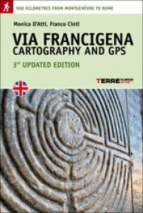
Via Francigena. Cartography and GPS
The first and only complete and detailed mapping of the Via Francigena. 38 legs, 900 kilometres on foot, from Montgenèvre to Rome
PREZZO : EUR 24,00€
CODICE: ISBN 886189254X EAN 9788861892545
AUTORE/CURATORE/ARTISTA :
Author: Monica D'Atti, Franco Cinti
EDITORE/PRODUTTORE : Terre di Mezzo Editore
COLLANA/SERIE : Percorsi
DISPONIBILITA': Disponibile
CODICE: ISBN 886189254X EAN 9788861892545
AUTORE/CURATORE/ARTISTA :
Author: Monica D'Atti, Franco Cinti
EDITORE/PRODUTTORE : Terre di Mezzo Editore
COLLANA/SERIE : Percorsi
DISPONIBILITA': Disponibile
TITOLO/DENOMINAZIONE:
Via Francigena. Cartography and GPS
The first and only complete and detailed mapping of the Via Francigena. 38 legs, 900 kilometres on foot, from Montgenèvre to Rome
PREZZO : EUR 24,00€
CODICE :
ISBN 886189254X
EAN 9788861892545
AUTORE/CURATORE/ARTISTA :
Author: Monica D'Atti, Franco Cinti
EDITORE/PRODUTTORE:
Terre di Mezzo Editore
COLLANA/SERIE:
Percorsi
ANNO:
2012
DISPONIBILITA':
Disponibile
CARATTERISTICHE TECNICHE:
32 pages
Paperback
NOTE:
English edition
3th updated edition
DESCRIZIONE:
Publisher's description:
The first and only complete and detailed mapping of the Via Francigena. The main itinerary and alternative routes, illustrating 38 legs - totalling 900 kilometres on foot - from Montgenèvre to Rome along the historical route through Piedmont, Lombardy, Emilia, Tuscany and Lazio: maps and all the information you need to find your bearings. From the authors of the Guida alla Via Francigena.
- 3 large colour maps
- Divided into legs that can easily be separated by tearing along the dotted line
- 42 detailed maps on a 1:30,000 scale
- Elevations
- Complete GPS data
GENERE: Guide ,Libri ,


